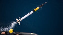
In the Coordinated Robotics expedition, the Schmidt Ocean Institute aims to create an army of robots that can be left unattended to take photos, survey specified areas, and map out regions of the ocean floor. By replacing divers with robots that can coordinate to conduct specific tasks, future expeditions will experience reduced cost, effort, time, and resources for detailed ocean exploration.
To begin developing and testing the robots and the algorithms that coordinate their efforts, Oscar Pizarro of the Australian Centre for Field Robotics (AFCR) at University of Sydney led a two-week trial expedition with the bots this past spring. A high-capacity supercomputer aboard the ship Falkor stored and analyzed the large amount of data collected by the robots as they carried out missions on the Scott Reef between Australia and Indonesia.
Experts in robotics, electronics, software, and marine sciences from several universities and institutions constituted the team. Together, they build, maintain, launch, monitor, and retrieve numerous autonomous underwater vehicles (AUVs). The AUVs take deep-sea pictures, create 3D images with sonar instruments, and perform chemical measurements at various depths. The swimming robot squad also consists of gliders, Lagrangian Floats, and autonomous surface vehicles (ASVs) to take surface measurements of salinity, temperature, currents, and other characteristics.
ASVs also monitor the position and well-being of the AUVs. The ASVs stay at the surface, sending sensory data and any alerts from the AUVs back to the ship for computer analysis and storage. Because the AUVs are too deep in the water to have a GPS, the ASVs also remind the AUVs of their location when they lose track of their position.
The robots were deployed on a detailed mapping expedition of the coral habitats and lagoon of the Scott Reef. A second task required the robots to map a large area with low amounts of coral habitats. From this, they developed algorithms to identify spots of potential interest and reduce the amount of unnecessary data collected by the robots. Another mission had robots take chemical and current measurements, which were compared to data taken aboard the Falkor.
The team collected 400,000 photos over the two weeks, terabytes of visual information each day. While the expedition supplies marine biologists with copious amounts of visual information, the team looks to obtain quantitative data with help from off-team marine enthusiasts and experts.
Post-doctoral research engineer Ariell Friedman compiled the 3D images and photos of the reef on a new website called Squidle. When visiting the site, participants can help determine which pictures have relevant content. Anyone from students to marine experts and enthusiasts are invited to help the team annotate and classify the contents of the photographs. The goal is to build a human-generated database that will serve as a template for future digital visual analysis and determine relevant footage.
